What are latitude and longitude?
The Earth is a globe and latitude and longitude are tools that allow you to find any point on its surface.
The Equator line has been chosen as the 0 value of the latitude . < / p>
If you cut the world in half along this line, you would get a horizontal plane.
Latitude is measured in degrees, between 90 and 0, in both hemispheres. The curve represented by all 90 ° of each hemisphere is divided into imaginary lines called parallel , because they are all parallel to each other and therefore also to the Equator.
Since the Earth is very large, the space between one degree of latitude and another (which corresponds to 111 km) is further divided into 60 minutes ; each minute is divided in turn into 60 minutes seconds . The symbols for degrees, minutes and minutes seconds are as follows:
Degrees: °
Minutes: '
Seconds: "
To find something very large, like a city, the first two numbers are enough. For example, London is found at 51 ° 32 'N . The location of a single building, on the other hand, will also require the third number.
London's longitude is set to 0, which brings us directly to the second part of the answer.
Longitude is a series of 360 imaginary lines that go from one Pole to another. London is located on line 0 and from there they start 180 ° east and 180 ° west.
During the course of a day (24 hours) the Earth rotates 360 °. 360 divided by 24 gives 15 degrees for each hour. The lines indicating every fifteenth degree of longitude are called meridians .
Meridiano comes from the Latin word meaning "noon" and therefore there are 24 different noon points that divide the world.
Longitude is calculated by making the difference between the noon point closest to you and the reference noon point, which is Greenwich (London ).
The difference can be positive (if you are in the east) or negative (if you are in the west).
To calculate it, therefore, you need to use a clock.
This is why it was very complex to do this until 1759, the year John Harrison, a Yorkshire watchmaker, created the H4 , the first reliable watch even on a nava.
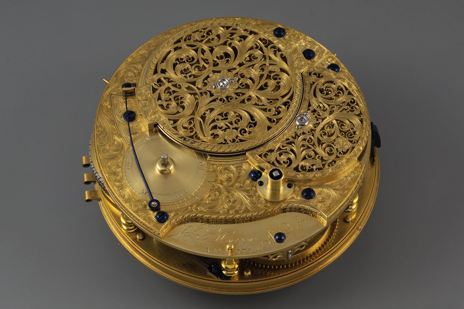 Clock H4
The previous ones, or the hourglasses, were in fact inaccurate due to the jolts of the ship. But why is Greenwich midday so important? Because in Greenwich, an astronomical observatory near London, the Prime Meridian passes, the point at 0 ° longitude.
The merchant ships of London adjusted their clock in synchronization with that of Greenwich where, at Flamstead House, a building on which the time ball was located, five minutes before 13:00 a large painted wooden ball was hoisted on the roof of the observatory.
At the exact time the ball was dropped and anyone, even from a distance, could synchronize their instruments. Greenwich Mean Time quickly became the reference for everyone.
In 1884 a conference of twenty-five nations formalized this agreement in Washington. If you go to Greenwich, you may find yourself straddling a line that divides East from West!
Across from Greenwich is the international date line, which passes into the Pacific Ocean. It is so called because it has been established that by crossing it, in one direction or another, the date must be changed. If this was not the case, you could move east from Greenwich and return to your starting point, but ... the day before!
This is not possible with the international date line. Passing it to the west, you are forced to reach the following day in your current calendar. But the funny thing is that instead, as you pass it towards the east ... you go back in time (even if only by one day!).
Like latitude, longitude is indicated by three digits that include degrees, minutes and minutes seconds.
When defining a point, the latitude (North / South) is usually indicated first and then the Longitude (East / West).